Picking a mechanism for Offroad navigation is not easy. There are various options to choose from and you have to weigh in various key features, including the capabilities to download maps for offline viewing.
I have been looking at several options for a few years now and tried out both pc based solutions as well as tablet based ones. Ultimately while I enjoy having a pc while put, the form factor, even with a nice ram mount is just not super conducive to map viewing, panning, and overall usage while in a vehicle. Yes you can do it, but after using a tablet, all I can say is why would you want to!!! The only real pro for going with pc form factor is there are a lot of rugged pcs out there to choose, they are pricy but you get something expedition quality. Panasonic tough books and Armor are some brands to look into.
As far as tablets go you are going to have the usual debate, iPad vs Android. I will be honest there are pros and cons to each. I think the Android platform has a lot to offer, however I decided to go with the iPad route, mostly because I can just afford one tablet and it has to serve many purposes. Also...after using a android based phone for two years I was happy and ready to jump back to iOS. From a hardware perspective Android will soon have one leg up as Panasonic is looking to reveal their Toughpad series of android tablets this month. These are full mil-spec tablets that can survive just about anything...and yes there is going to be a premium for them!!!
So by now you guessed it, I a down to an iPad and a handful off apps that let me function with maps! I currently have 5 map apps installed.
1. Default google maps 2. Google Earth 3. Motion-X GPS-HD 4. Gaia GPS 5. Topo Maps
Over the next few weeks I will post reviews of each. Pros cons, and overall perceptions.
Road Conditions: The first mile or so of the trail is probably the most challenging. There are a few places where low clearance vehicles will get hung up. I would say that any standard SUV with a good driver at the wheel can get in and out ok. Be sure to close the gate behind you.
The only other part of the trail to be aware of is just before the lake. There is a switchback that will likely require a three point turn. Good luck with a trailer :-).
I do have a video of the first part of the trail somewhere and will post it when and if i find it.
Trip Report: The NorCalFJ High Sierra Trip is always an amazing adventure. For us it is really a chance to get away from everything and once again enjoy the great outdoors in an amazingly blessed area of land. There is really something for everyone around here! The teardrop, as always made it through without a problem and provided a great level of comfort and warmth that is unmatched!
For Katie and I this was a 5 night, 6 day trip. Our longest outing with the teardrop so far. We got into the NorCal FJ base camp late on Tuesday night and decided that we would go out and explore some other nearby campsites. We found a great spot that was not to far away from the camp and gave us some great views and privacy.
Due to the length of the trip I had some concerns about power. The battery held up well but I recharged it twice by running the FJ. I also setup the FJ's second battery to feed the trailer battery overnight. Overall worked well and didn't have a problem.
Another concern was water - the trailer has about 19 gallons of water storage. We were fortunate to park next to a creek so we had plenty of water for showers, dishes and putting out fires. The 19 gallons ended up being drinking water...and there was plenty of it.
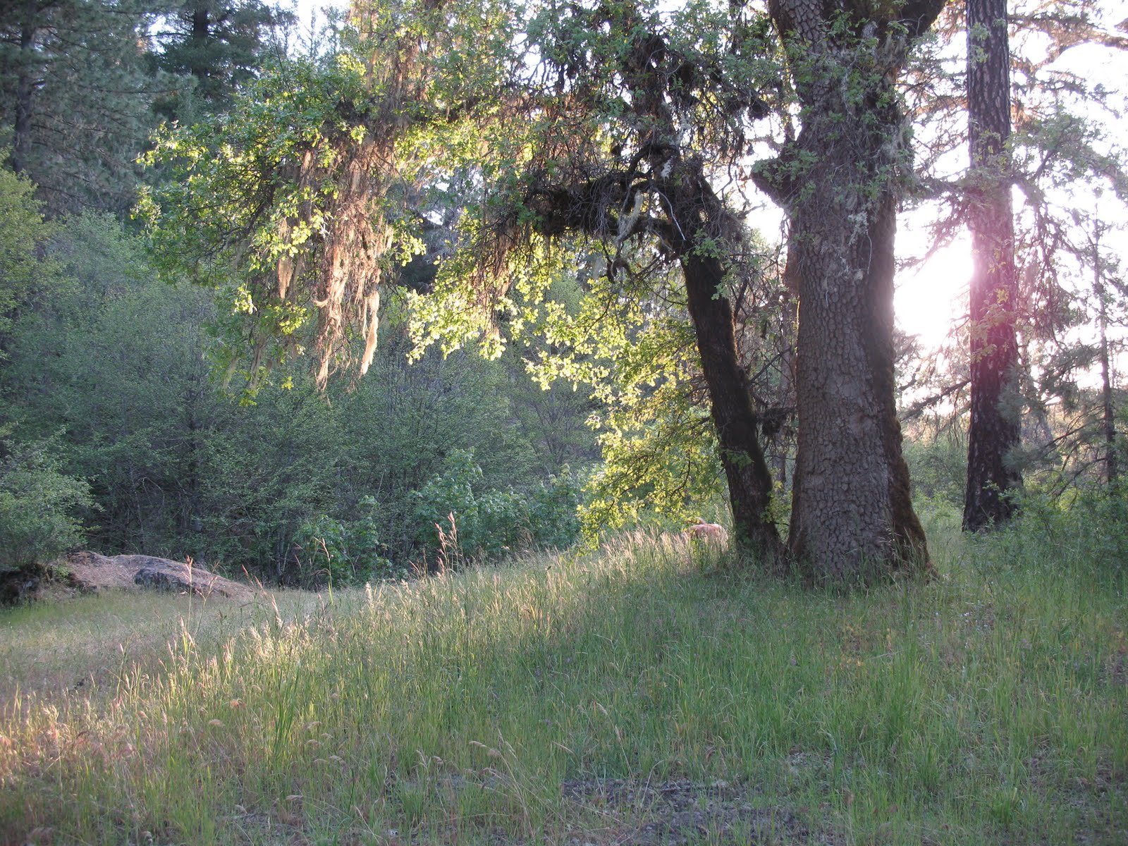
Here is a picture of our base camp - it was near a nice little creek which is always fun because I can get out of bed, make some coffee and head out to do some fishing all before the wife wakes up. As with any small remote creek I have been to, the fish here were happy to be fed dry flies of almost any type. I find dry flies much more exciting but there are times when they just are not as productive. Regardless - this creek is is brook trout heaven! All fish were released.
Our Campsite
I had a new chair to try out as well - probably the best 80$ I ever spent. It reclines so much you can easily fall asleep in it! I should also mention that it is great for star gazing!
Comfy Camp Chair!!
After lounging around camp pretty much all Wednesday we decided to go explore on Thursday. We headed off to Laurel Lakes from our camp:
Ran across Bozley from BozTec on the way over there. A few others showed up not too much later. The lake is always a blast, the last year when I was here I waded pretty deep into it and was having a blast. I always tell myself I should bring my pontoon boat when I come here but i never do.
Laurel Lake
After spending the late morning at the lake we headed off to a trail head that is on the road back to the campsite (see map above). We did this as a day hike and had a lot of fun! As a side note we are about 4 months into crossfit and I have to say I was impressed how well we handled the altitude and the hike overall.
Near the Peak
Walking through the bowl
Trying to reach a CARLA repeater - no luck.
Swithbacks!
Friday was a rest day - mostly hung out around camp!
A great day just stay and enjoy the views
Saturday was a day hike to see the waterfalls. We could not find a path down to the waterfall though so we headed back and then got rained and hailed on while making our way back to camp! High winds knocked over our shower tent! Other then that no major damage besides being wet!
After that success we went into town and got a burger before heading out to look at the Devil's Postpile monument. The monument itself is odd..however the landscape around it is very nice. I saw a bunch of people fly fishing....and of course I forgot my rod! Grrr..
.
The odd formations at Devil's Postpile
Major was happy to get out and about!
From there we did the hike down to rainbow waterfall....worth doing if you have the time!
Sunday we broke camp early (packing up is so much nicer without a tent!) as we wanted to check out the ghost town of Bodie before we went home. Now that was really an interesting place to go visit. It really makes you wonder what it would have been like live back then.
The Bank - or what is left of it.
The safe at the local bank!
Fire on the way home and 5$ per gallon made me tap into my strategic reserves! Helps to have 20 gallons of gas tucked away on the trailer!
Ended up going back through Sonara Pass - this was first time I definitely felt some struggle towing the trailer. However...that was low grade fuel, 10,000+ feet and some steep climbs.
Gold Lakes is a beautiful location with some great opportunities for wheeling, assuming you wait for all the snowfall to melt! There is a great set of campgrounds around the back side of the lake via an off road trail (see video). The trail itself doable by most stock 4x4s but be prepared for some slow going and some bumps and potential bruises if your vehicle is totally stock. This is not a trail for a hybrid style SUV or an AWD vehicle (aka Subaru)…you will need a 4WD system with a locking center differential…or a buddy willing to give you a tow now and again.
I made it through with the teardrop just fine :-)
My original plan was to meet up with the Norcal FJ group (www.norcalfjs.com) for our annual camp Wampler ride home(http://www.wamplerfoundation.org/). Essentially we help out with transportation back to an easily accessible bus pick up site from the camp. It’s a fun chance lend a hand for a good cause.
Due to all of the snow this year the camp was cancelled, however some of us still wanted to head up to the amazing area. Unfortunately the road that goes through the camp was covered with a fair amount snow so none of the trails that we wanted to go on were accessible.
Got the itch to head out for a short little run into the Sierras, this was my first run of the year into the Sierras and I was scared that there would still be too much snow out there to really get anywhere nice. My new 3wt fishing rod had just arrived and it had to start getting a workout so a trip was in order.
I drove straight up HWY 50 to Ice House Road and then turned on Peavine Ridge. I’m not giving any more direction from their as I kind of want to keep this place to myself, call it what you will – if you find you will know why!
The route to get there was not difficult but as you will see from some of the video there is a LOT of overgrown brush in the area so you will get some very nice pin stripes if you go too far off road here, the abundance of snow has caused the manzanita to grow like I have never seen before. If it makes some of you feel better it is really just the first round of pin stripes that hurt….after that the only thing that bothers you is the sound of the Manzanita scratching against your paint (similar to nails on a chalk board). It seems like a lot of the trails that I have been on recently are overgrown….maybe it is just a year for some solid pin stripes!
Of course once I got there i had to put on the waders and try out the waters!
Ended catching a total of 5 and three got off the hook, not bad for 2 hours!
A fire caused a lot of damage to this area many years ago - this tree (and others) were planted to help re-forest the area.
Everything is in bloom!
Good thing about silver is you can't see the pinstripes from afar :-)
Leaving -
The next morning I was going to try to make my way to HWY 88 via Silver Fork Road, but much to my dismay the road still had a fair amount of snow on it (Starting at 6100 feet). Now…the snow was passable I have made it through worse with the FJ but I had to play it conservative for a few reason: 1) I was alone, 2)I had never tried snow cross with the trailer and didn’t want to find out exactly how much drag it would cause and 3) I still had another 1000 feet to climb before I would start going downhill again…the snow was only going to get worse.
This Memorial Day with all of the snow that we received we wanted to make sure that we went where there would be little chance of snow. Additionally we wanted to keep it relatively close to home, so we ended up going to Mendocino national forest.
Day 1:
We left late on Friday the 27th and drove up I5 to the Maxwell exit and then headed west until we got to Goat Mountain Road. Goat Mountain Road is a fairly easy road that takes you by Stoney Creek and into the Mendocino National forest, the last stop for gas is just before East Park Reservoir.
The road is in pretty good shape, a Honda Civic could easily make it :-). Below is a brief section of the drive (I apologize in advance for the music and noise...didn't get a chance to edit the sound):
Our first campsite was just off of Goat Mountain Road, we found a little camp site at the confluence of Little Stoney Creek and Trout Creek. I did try some fishing but had no luck, I did spot some though. It was tough to cast a fly in such cramped quarters.
Camp on Night 1
Little Stoney Creek (Next to Camp)
Short Path to Camp - Major was fond of this spot
Another view of the Creek
Katie the next morning
Esty the next morning
Day 2
Had a great breakfast in the morning - Katie is getting quite skilled cooking out of the small galley! Didn't get too cold at night but we did realize...a little late....that the trailer was not exactly level...which meant that I got squished all night :-). We packed up camp and the sun that was out earlier quickly got covered by some clouds, we didn't get a ton of rain but enough to where we spent a few hours of the afternoon at the second campsite just taking a nap in the trailer waiting for the rain to clear.
The road again was in fairly good shape, 16N44 got a little bumpier then Goat Mountain but overall it wasn't bad....possible in a Civic - but probably a better fit for a Subaru. I should note that the spur down to Wyley Glade has a lot of overgrown brush and you will get some nice pinstripes if you head down it. I of course went down it! Some video:
The campsite was great overall - there was some glass around the campfire ring but we were able to clean up most it. Here are some pics of the trail and of the camp site:
Right before the spur down.
The full setup - shower and all!
The rain broke around 4:00pm, Major and I went for a hike all the way down the trail. It would be possible to get a vehicle down there(and there is a really nice camp site) but the road is very overgrown and much more rutted maybe a 3 or a 4 on a scale of 10.
Day 3
We got an early start on Day three, packed up camp early and hit the road down to Bartlett springs and also to figure out where the heck we wanted to go next! I knew of a few additional camp sites but really just wanted to explore. I was very glad to have the 20 gallons of extra fuel with us, I had to put a jerry can into the FJ for Day 3.
We drove a lot on Day 3, or at least it felt like a lot (red line below).
We had a few great stops! The first one was just as we got to the crossing of the north fork of Cache Creek, the water cross was pretty shallow maybe 18 inches, the water flow was not too fast at the crossing. I saw a Tacoma prerunner do it so i'm sure its possible in 2wd. Here are some pics from that area:
The crossing - deeper then it actually looks.
Downstream from the crossing
Upstream from the crossing - I think this was the cast that broke my rod :-(
From there we headed on our way to Bartlett Springs, an old stage coach stop. It was apperently a very nice place but closed after a fire in the early 1900s, since then apperently someone thougt it was fun to burn it down to nothing. All that is left now is some cement structures and the spring.
The spring still flows
Structures like this are all that is left
We had lunch here and then headed out to Bear Creek - here are some more pictures of the road along the way and the camp site.
Always wierd how you see cars left out in the middle of nowhere
Creek by Campsite #3
Sun starting to set at campsite #3
Day 4
On Day 4 we got an early start as we wanted to get home at a reasonable hour. Still had some time to take some pictures on the road home though :-). These are from hwy 20 and hwy 16.